AdaptCoast
Adaptive Coastal monitoring and modelling of intermittent anthropogenic and natural impacts on beach-dune systems.
A research project of Delft University of Technology and Twente University. Coastal beach-dune systems worldwide are under increasing pressure from sea level rise and increasing urbanization. A lack of knowledge on the (long-term) impact of anthropogenic events on coastal dune development impacts our possibilities to manage these coastal systems.. The AdaptCoast project aims to develop new adaptive monitoring, analysis and modelling tools to obtain new knowledge and tools to assess the long term human induced impacts on beach dune systems. The AdaptCoast is in some aspects the successor of the CoastScan project.
CoastScan
A research project of Delft University of Technology to observe dynamic processes on the coast like erosion during storms, movement of sand bars, development of the coastline, aeolian sand transport, soil moisture or effects of bulldozer works.
Dynamic Coasts
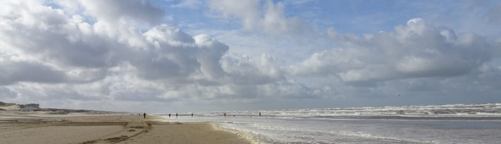
Coastal zones are very dynamic areas which are continuously changing. Because of climate change, storms are becoming more frequent and heavier. Therefore it is very important for coastal management to monitor coastal deformations with high accuracy. This allows to model and to predict coastal variability and processes like for example a storm and the recovery of the beach afterwards.
Permanent Laser Scanning
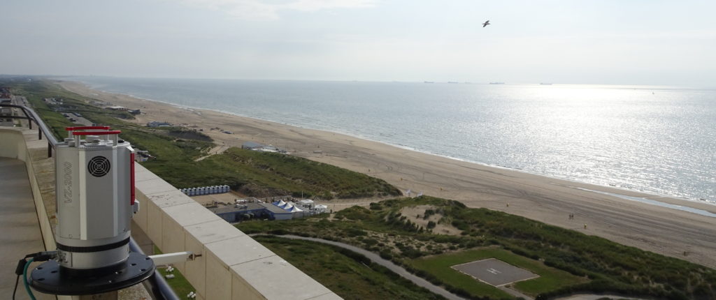
Current coastal management is based on observation techniques that are either low in spatial resolution, for example satellite data, or low in temporal resolution, as for example yearly measurement campaigns with airborne laser scanning. To fill this gap, the CoastScan project is using a new technique called Permanent Laser Scanning (PLS). Permanent Laser Scanning uses a laser scanner mounted on a building close to the coast, which continuously performs high resolution scans during a period of several month up to years.
The data is collected at three different locations along the Dutch and Belgian coast. The resulting data set contains a 3D representation of a section of the coast of about 1km length for every hour in the observation period. This data is then used to improve understanding and modelling of coastal deformation processes.
 Preparations at the Department of Hydraulic Engineering of Delft University of Technology and first data collection in Kijkduin started in 2016 and was presented as a
Story of Science by the university.
Preparations at the Department of Hydraulic Engineering of Delft University of Technology and first data collection in Kijkduin started in 2016 and was presented as a
Story of Science by the university.
Today the project is a cooperation between the Department of Geoscience and Remote Sensing and the Department of Hydraulic Engineering at Delft University of Technology. It is mainly funded by NWO among many other partners in industry and academia.