18 March 2021, 9:30 – 12:30 via Zoom
Introduction:
The increased availability of tools and technology to automate laser scanning has lead to advancements in permanent laser scanning (PLS), where a specific area of interest is observed via laser scanning continuously over an extended period of time. The resulting data is utilized for a large variety of applications and allows high resolution observation of small scale dynamic processes. Each of the applications comes with their own requirements on data quality and measurement accuracy. The continuous scanning from a fixed location provides the opportunity to further investigate error sources in terrestrial laser scanning (TLS) that have been neglected or remained undetected in conventional periodic or incidental measurement campaigns. Depending on the application, this also leads to the need for the development of error corrections, or at least quantification in order to provide a measure of confidence in the results.
The goal of this workshop is to bring different research groups, working on permanent laser scanning, together and exchange experiences and ideas on typical issues and error sources and possible corrections in PLS. We hope to benefit from sharing our experiences and to promote and facilitate future collaborations.
Agenda:
09:30 – 10:30 Block 1: Permanent Laser Scanning set-ups: applications an challenges
10:30 – 10:45 Break
10:45 – 11:30 Block 2: Error models and Calibration in PLS
11:45 – 12:30 Open Discussion
Block 1: Permanent Laser Scanning set-ups: applications and challenges
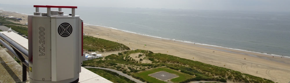
- Mieke Kuschnerus (Delft University of Technology): CoastScan: Error sources in PLS of the coast
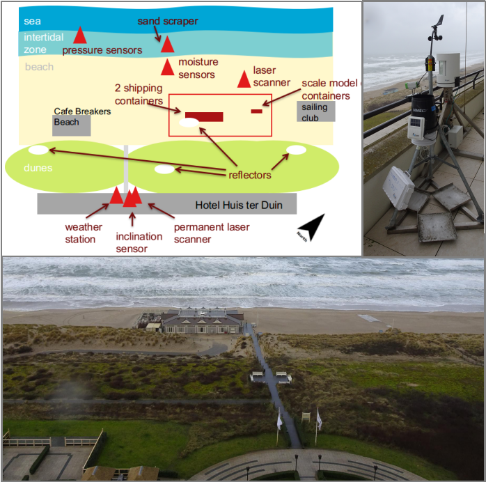
Within the CoastScan project a RieglVZ 2000 laser scanner takes hourly scans from the balcony of Grand Hotel Huis ter Duin in Noordwijk, the Netherlands, overlooking about 1km of dunes and sandy coasts. During a fieldwork campaign in February/March 2020 reflectors were placed at different locations in the dunes and additional measurements were taken with a weather station (among other instruments). The data of this fieldwork campaign is now evaluated to identify and quantify error sources in order to filter the data for quality and to derive corrections.
- Daniel Schröder (DMT, University of Mining and Technology Freiberg): The atmosphere as a restrictive influence on measurement results of a long range laser scanner
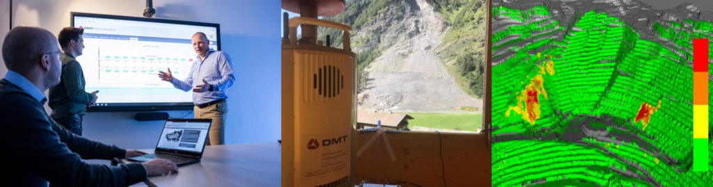
Atmospheric-induced deviations within geodetic measurements have been known since the last century, but gain new relevance with the emergence of permanent installations and the associated quasi-time-continuous acquisition. The influence can no longer be minimized by campaign-wise observations at selected times. Due to atmospheric refraction effects, apparent deformations of up to several decimeters between multitemporal point clouds are possible. This systematic influence on the measurement result suggests a deformation that is not present in reality. Here an installation in the Valsertal (Tyrol) is presented and systematic error influences will be discussed.
- Annelies Voordendag (Innsbruck University): Discoveries and challenges of an automated and permanent laser scanning system at an Alpine glacier
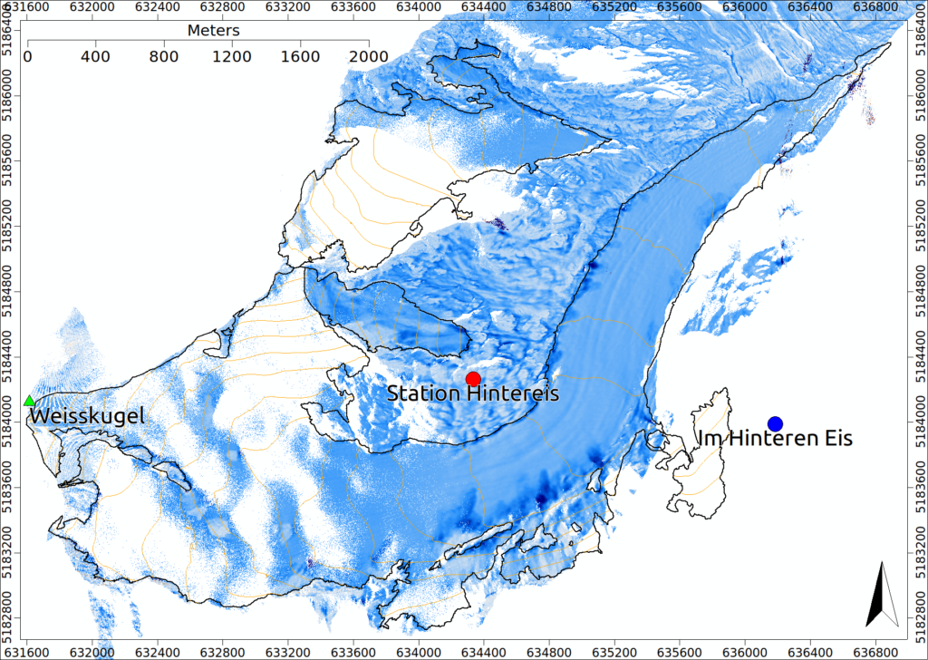
A terrestrial laser scanner (TLS) of the type RIEGL VZ-600 has been permanently installed and automated at Hintereisferner glacier located in the Ötztal Alps, Austria, to measure surface height changes. The presentation introduces the setup of the TLS system and its automation procedure. A case study shows the possibility to measure snow distribution at the glacier after a snowfall event, together with snow erosion and deposition caused by avalanches.
- Eetu Puttonen (Finnish Geospatial Research Institute FGI): First year experiences on setting up and managing a permanent laser scanning station in boreal forest
Block 2: Error models and Calibration in PLS
- Gabriel Kerekes (University of Stuttgart): Elementary Error Model for TLS Measurements
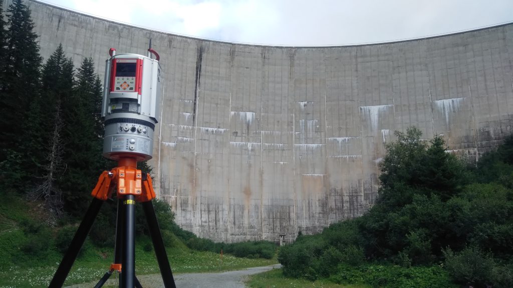
Stochastic information of terrestrial laser scanning point clouds is still a highly disputed topic. The elementary error theory is one possibility of describing the error sources impact by means of variances-covariance matrices. An application of the elementary error theory is presented on point clouds of a concrete water dam scanned with a hybrid laser scanner. The focus is set on instrumental and atmospheric error sources.
- Alain de Wulf (Ghent University): Development and assessment of different calibration procedures for PLS
- Lars de Sloover (Ghent University): Research into the intrinsic accuracy of PLS (in different beach zones)