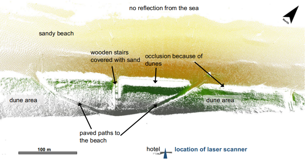
Part of our data set from Kijkduin, covering daily scans in January 2017 has been published via 4TU Research Centre: CoastScan: Data of daily scans at low tide Kijkduin January 2017 and can now be accessed online.
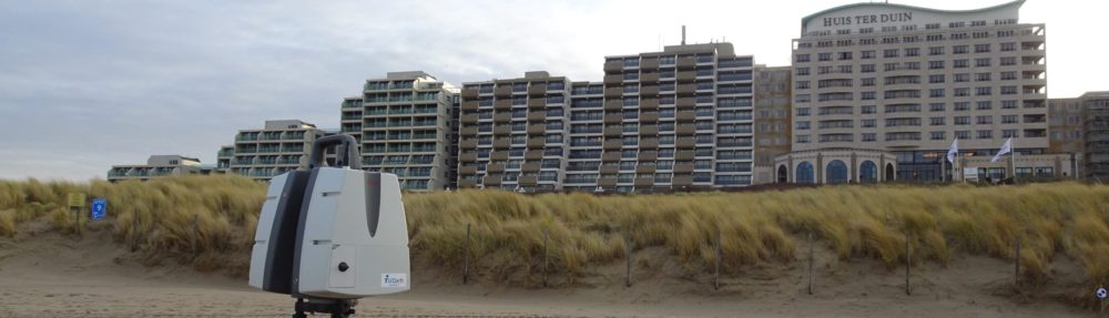
Part of our data set from Kijkduin, covering daily scans in January 2017 has been published via 4TU Research Centre: CoastScan: Data of daily scans at low tide Kijkduin January 2017 and can now be accessed online.