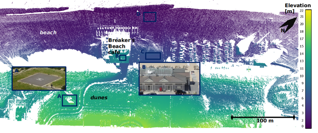
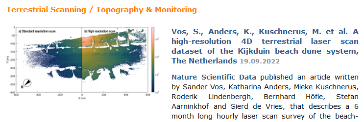
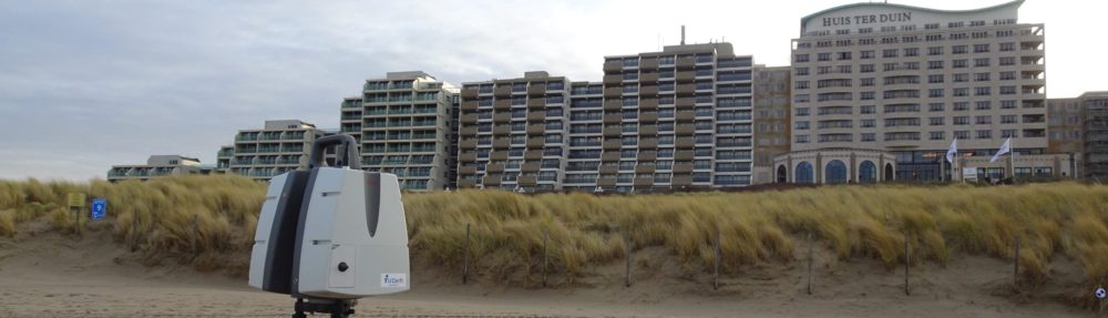
A new post about CoastScan and the follow-up project AdaptCoast appeared in the news of the Faculty of Civil Engineering and Geoscience of Delft University of Technology.

A new post about CoastScan and the follow-up project AdaptCoast appeared in the news of the Faculty of Civil Engineering and Geoscience of Delft University of Technology.
The article by I. Barbero-García was published in the International Journal of Applied Earth Observation and Geoinformation. It deals with the automatic detection of bulldozer works on the CoastScan study site in Noordwijk. The bulldozers are detected in images from video cameras and sightings are compared with changes detected in the 3D point clouds from permanent laser scanning.
D. Hulskemper presented his work at the ISPRS workshop O3DM on 15 and 16 December 2022 in Würzburg, Germany. For his Master thesis he is working on grouping and analyzing 4D objects by change derived from the data set collected for CoastScan in Kijkduin, using unsupervised machine learning. His results allow to interpret and compare weather conditions with different types of surface activities on the sandy beach in Kijkduin. The full contribution can be read here: Link.
On the RIEGL website and in the RIEGL newsletter the latest publication by S. Vos et. al was mentioned, describing the CoastScan setup in Kijkduin and the 6-month data collection: Link to RIEGL-website. Next to a link to the publication in Nature Scientific Data, the text describes the motivation and highlights the specification of our RIEGL VZ-2000 laser scanner.
On 21-06-2022 the last scans were taken from the scanner location in Noordwijk. The scanner was removed in the following days and is sent for maintenance to the manufacturer. We thank Hotel Huis ter Duin for their cooperation and are now working on processing the collected scans of the past three years.
On 22 June 2022 we presented our latest work on assessing beach width variations on intertidal time scales using permanent laser scanning at the 5th Joint International Symposium on Deformation Monitoring in Valencia. The article with the details of this work will be published soon in the proceedings of the conference.
D.A.J. van Dieren: Anthropogenic beach deformations – Characterizing anthropogenic beach changes using laser scan and video data
D. Madi: Comparing the effects of winter storms Corrie and Eunice on Noordwijk using laser data
Debora van Dieren and Dalia Madia have successfully completed their final Bachelor projects and presented their results on June 16th. They used our CoastScan data set to quantify storm damages (Dalia) and detect anthropogenic activities (Debora). Congratulations to both!
On June 7th 2022 we presented the CoastScan project and our latest results at ISPRS 2022 in Nice.
The results were also published in a short article: https://doi.org/10.5194/isprs-archives-XLIII-B2-2022-1055-2022.
Today our article “A high-resolution 4D terrestrial laser scan dataset of the Kijkduin beach-dune system, The Netherlands,” (https://doi.org/10.1038/s41597-022-01291-9) by S. Vos, K. Anders, M. Kuschnerus, R. Lindenbergh, B. Höfle, S. Aarninkhof, S. de Vries was published in the nature scientific data journal.
The article explains our latest data publication (https://doi.org/10.1594/PANGAEA.934058) on the PANGAEA repository for earth and environmental science data. All point clouds collected at the CoastScan location in Kijkduin during a six months observation period from November 2016 to May 2017 can be found here.