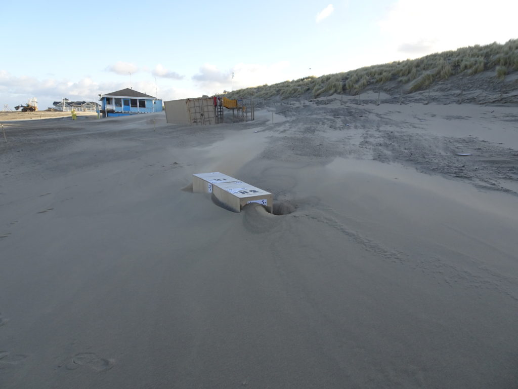
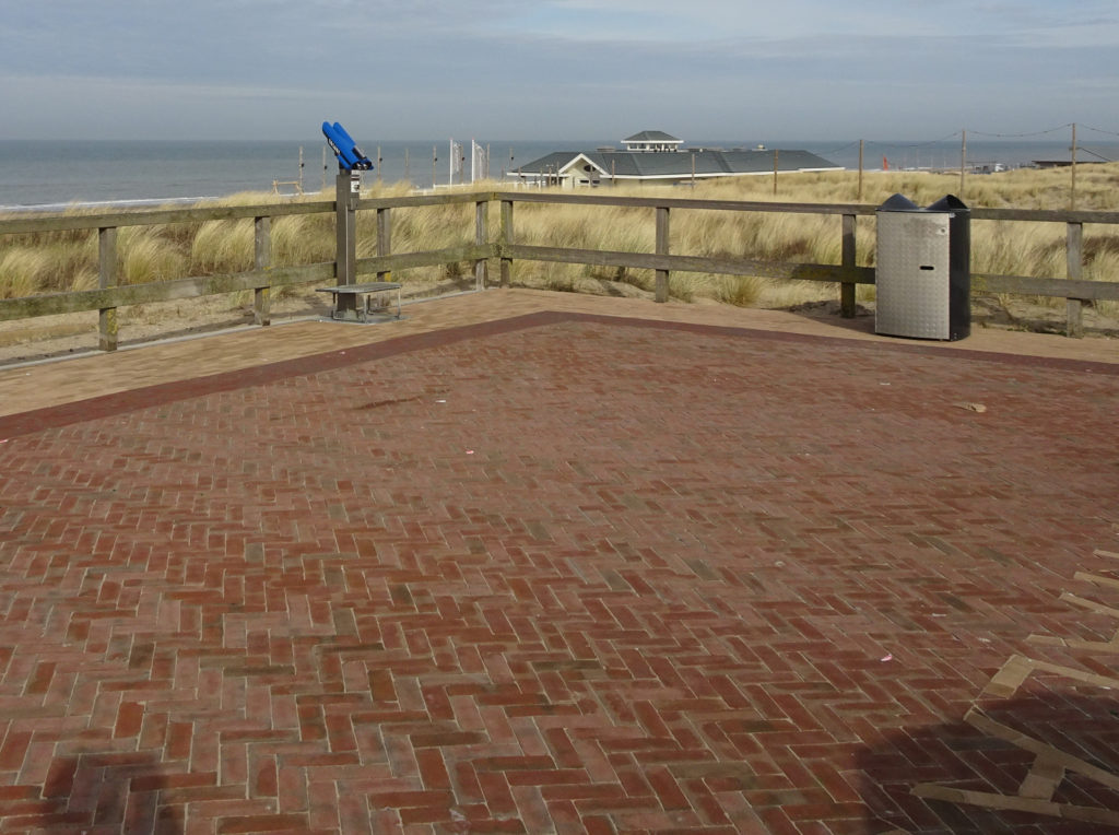
Observation deck paved

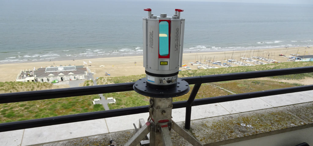
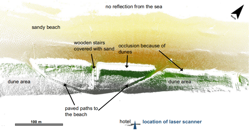
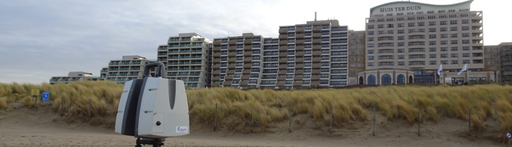
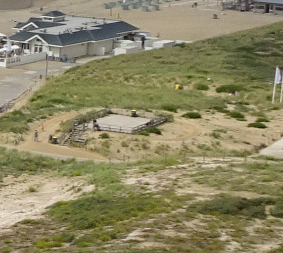
The observation deck in the dunes in Noordwijk is located to the north of our laser scanner and just within the field of view. At our monthly round, where we check on the location, take some extra scans of the dune foot and collect GPS measurements of the beach, we also measure the GPS coordinates of this observation deck. Until the beginning of this year the deck was made of wood. Now, since February 2021 the deck is paved with bricks. This will increase the stability as a reference in our point clouds. But of course, this change does not allow for comparison with the data of the deck before it was paved.

Laser Scanner moved 2 m North

On 2nd December 2020, the laser scanner was moved from its permanent position on the balcony of hotel Huis ter Duin in Noordwijk to a new fixed position on the same balcony, but about 2 m to the North of the previous position. The move was requested by the hotel. We are now working on methods to provide a fixed transformation that can be applied to the data to remove the resulting shift.

Break in PLS record for maintenance

From 25 June 2020 to 30 July 2020 there is a break in the data recorded with our permanent laser scanner. In this period the scanner was removed for maintenance activities. It was placed back on July 30th at the exact same location and is fully operational again since then.

CoastScan data set from Kijkduin published

Point cloud of the beach in Kijkduin taken with our RieglVZ-2000 laser scanner. Colors indicate height, from yellow (0 m close to the water line) to grey (14 m and higher, on top of the dunes and behind them).

Part of our data set from Kijkduin, covering daily scans in January 2017 has been published via 4TU Research Centre: CoastScan: Data of daily scans at low tide Kijkduin January 2017 and can now be accessed online.

Part of fieldwork extended to end of April

Part of our measurements in Noordwijk for the ScanEx fieldwork campaign are ongoing. Thanks to the restrictions of the use of public beaches because of the Corona virus outbreak, the two shipping containers could remain on the beach until the end of April. The weekly scans with our mobile laser scanner around the containers are continuing, as well as some of the measurements of wave data with pressure sensors. We also continue the collection of meteorological data next to the laser scanner (after a short break at the end of March).

Corona virus puts an early end to some of our measurements

Thanks to the closure of the Delft University of Technology because of the Corona virus outbreak, we stopped recording data with the weather station and removed all reflectors. We have data on the reflectors during four weeks, which is enough to evaluate the stability and potential error sources. Some last scans with the mobile laser scanner were performed on 14 March. Measurements with pressure sensors and sampling with the sand scraper are ongoing, as long as permitted.

The storms continue

The continuing storms show huge effects on our containers and model containers. A lot of sand is moved around and constantly creates changing shapes and erosion around them. The access road to the beach needs to be cleared daily and the works as well as the sand accretion cause a new shape of the neighboring dunes every time we come to the beach for measurements.

Effects of latest storms visible around shipping containers

We recorded wind speeds up to 12 bft in the first weeks of February 2020, the beginning of our fieldwork campaign ScanEx. The effects that the wind had on the beach, can clearly be seen around our shipping containers in the observation area. There has been (and continues to be) a lot of aeolian sand transport. The sand is blown away from the south side of the containers and accumulates on the north side. The two wooden boxes were placed directly on the sand before the storms. All sand from underneath was blown away and they appear more than 20 cm above the beach.